Newly released phosphorus data a critical part of freshwater solutions

Phosphorus data shared in series of reports released today are providing valuable information to protect Lake Winnipeg by identifying hotspots where research, resources and action must be focused.
Phosphorus is the nutrient that drives the growth of algal blooms on Lake Winnipeg – however, different sub-watersheds contribute different proportions of the lake’s total phosphorus load. The Lake Winnipeg Community-Based Monitoring Network (LWCBMN) is designed to identify localized phosphorus hotspots – areas that contribute higher amounts of phosphorus to waterways than other areas.
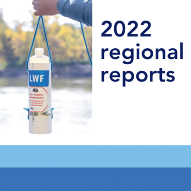
Data included within the 14 regional reports were generated by LWCBMN in 2022, the program’s seventh field season.
Coordinated by LWF, LWCBMN mobilizes citizens volunteers and watershed partners to collect water samples across Manitoba. Samples are then analyzed in a lab to determine phosphorus concentration, which is used along with water flow data and drainage area data to calculate phosphorus load – the total amount of phosphorus flowing past a site in a field season – and phosphorus export – the amount of phosphorus exported from each hectare of land in a year, expressed as kg/ha/yr.
Highlights of the 2022 field season
The 2022 field season was extremely wet: the winter of 2021-2022 provided most of southern Manitoba with more than 150 cm of snow, the third highest amount of snowfall since 1872. Additionally, record precipitation in April and May saw large amounts of rain and snow falling on mostly frozen, impermeable soils, leading to flooding across southern Manitoba.
Phosphorus is transported to Lake Winnipeg via water flow, which means we can expect higher phosphorus loads in wet years. As well, phosphorus concentrations within the rivers that flow into Lake Winnipeg are typically higher during floods, since water sits on the land for extended periods of time, allowing phosphorus within the soil to dissolve into standing water.
To effectively address phosphorus loading to Lake Winnipeg, LWCBMN’s long-term data set allows us to identify recurring patterns in phosphorus exports, which persist over multiple years.
LWCBMN’s 2022 data once again saw phosphorus hotspots in Manitoba’s Red River Valley, with high exports occurring in the Seine River watershed in south-eastern Manitoba, and on the western side of the Red River at the international border.

Focusing phosphorus-reduction efforts in persistent, recurring hotspots is critical to improving the health of Lake Winnipeg. LWCBMN data supports evidence-based decision-making and is valuable information for academic researchers, watershed districts, land managers and regional policy makers alike.
Pandemic-related lab closures throughout 2020 and 2021 created delays in both lab and data analysis. With 2022 data now released, LWF will continue the analysis of data collected in 2021 and 2020. That information will be released later this spring.
In addition to regional reports, all LWCBMN data will also be shared on Lake Winnipeg DataStream, an open-access online portal.
Preparations are underway for LWCBMN’s ninth field season, which will start as soon as the snow begins to melt.
Explore LWCBMN's 2022 regional reports
- Assiniboine West Watershed District
- Central Assiniboine Watershed District
- City of Winnipeg
- East Interlake Watershed District
- Inter-Mountain Watershed District
- Northeast Red Watershed District
- Pembina Valley Watershed District
- Redboine Watershed District
- Seine Rat Roseau Watershed District
- Souris River Watershed District
- Swan Lake Watershed District
- West Interlake Watershed District
- Whitemud Watershed District
- Winnipeg River System
Update: An earlier version of this news post included information about apparent hotspots occurring along the Winnipeg River. After reviewing our data and consulting with our science advisors, we have removed water samples collected at hydroelectric generating stations from our dataset. Read more on our website about how we reached this decision, and how we are continuing to work with our partners to generate credible, useful data that complement government water-monitoring programs, enrich our understanding of phosphorus loading and point the way to collaborative solutions.