Highlights from the Lake Winnipeg Community-Based Monitoring Network Gathering
Posted: March 20, 2025
For the first time since 2020, volunteers, partners and data-users of the Lake Winnipeg Community-Based Monitoring Network (LWCBMN) gathered together to learn about network activities, explore how LWCBMN data are being used, and understand the importance of focusing on phosphorus to address Lake Winnipeg’s algal blooms.
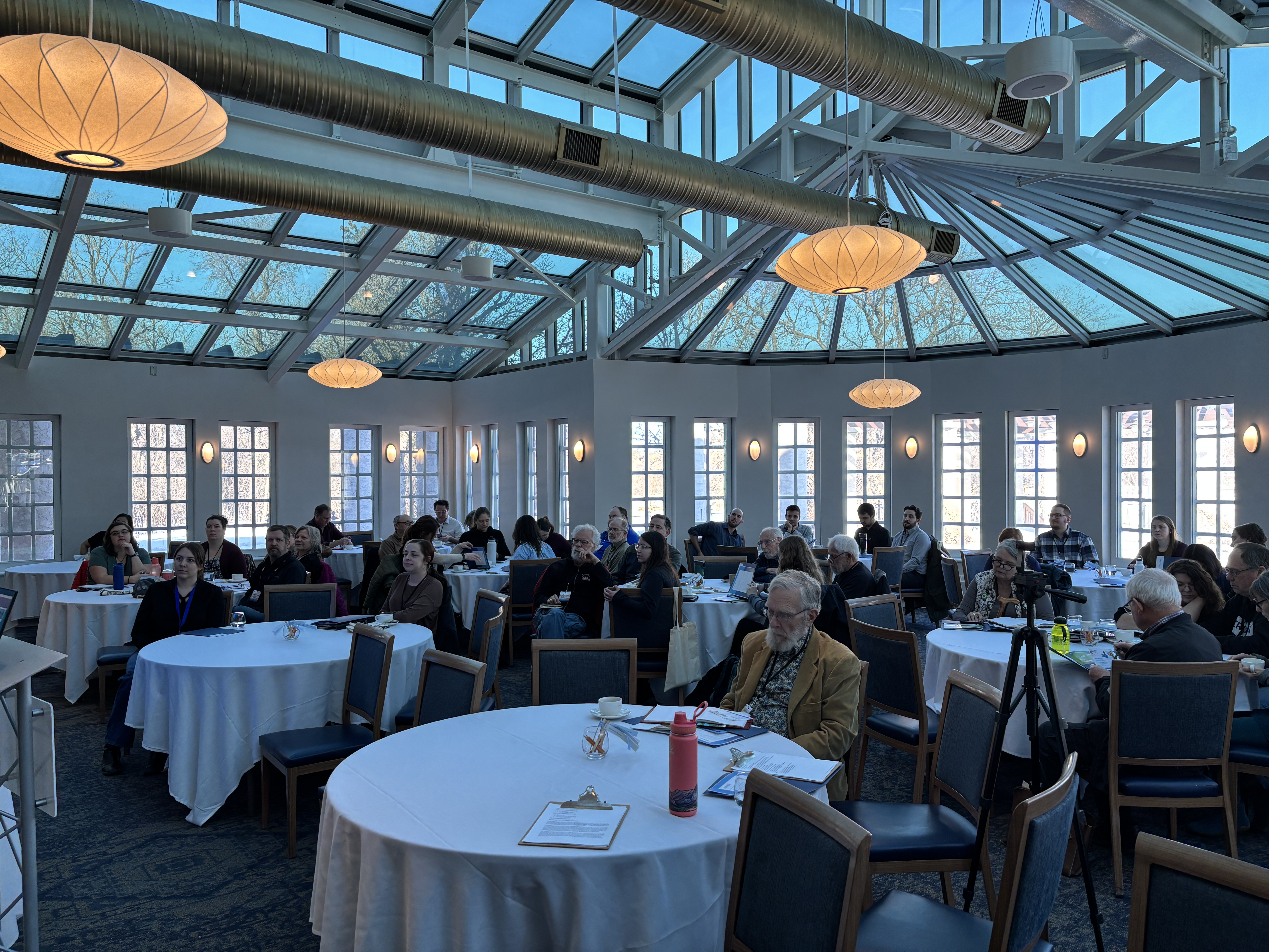
The gathering, held at the Assiniboine Park Pavilion on March 6th, was the first LWCBMN event since the COVID-19 pandemic disrupted LWCBMN activities. Bringing back our annual gathering is one step in our plan to return to a regular data-sharing schedule where last year’s data is released prior to the next field season.
LWF’s programs team kicked off the gathering by providing an update on LWCBMN activities. Karl Friesen-Hughes, LWF’s Field and Data Technician, presented the network’s 2023 data, freshly released online and on Lake Winnipeg DataStream; Chelsea Lobson, Programs Director, spoke about how the data are being used in evidence-based decision-making; and, Fallon Moreau, Program Coordinator, shared the history of the network and launched the 10th field season.
Overall, this was an uplifting day where LWCBMN volunteers, partners, LWF staff and science advisors got to connect and learn from one another. We were thrilled when questions prompted big conversations that had everyone in the room engaged – discussing data gaps and the many questions that remain about how to address phosphorus loading from the watershed. We were so pleased to witness and celebrate the importance of LWCBMN and acknowledge the effort of all the volunteers and partners who participate.


LWCBMN’s 2023 data
Coordinated by LWF, LWCBMN mobilizes volunteers and partners to collect water samples across Manitoba. The network is identifying phosphorus hotspots – localized areas that contribute higher amounts of algae-causing phosphorus to local waterways than other areas.
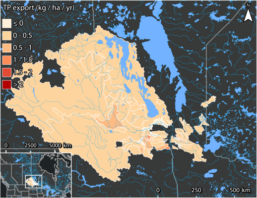
Newly released data from 2023 adds to a growing LWCBMN dataset that dates back to 2016. Every year tells a slightly different story depending on the timing and magnitude of the spring snowmelt, weather events like rainstorms, and land-use changes. However, through this annual variability it’s important we stay focused on persistent phosphorus hotspots.
In contrast to 2022, 2023 was a dry field season. Most sampling sites had relatively low flow, resulting in low phosphorus export. However, even with the low flow, some moderate phosphorus hotspots appeared in southwestern Manitoba – specifically Roseisle Creek near Roseisle and Riviere aux Marais near Christie, which show up in red in the 2023 map.
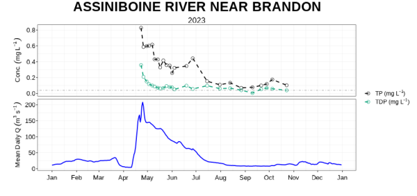
In 2023, LWCBMN data analysis included measurements of both total and dissolved phosphorus data for the first time. The different proportions of dissolved and particulate phosphorus in a sample can help us start to understand the source of phosphorus from the watershed. For example, dissolved phosphorus typically comes from sources like sewage, manure and fertilizers, while particulate phosphorus is more likely to come from sources like soil erosion.
All 2023 total and dissolved data is available on Lake Winnipeg DataStream and all 2023 regional reports are available on LWF’s website.
Making use of LWCBMN’s phosphorus data
With eight years of data in hand, action is being targeted to persistent phosphorus hotspots identified by LWCBMN - specifically those that have appeared repeatedly in the Seine Rat Roseau Watershed District.
LWF advocates for the use of LWCBMN data to target federal funding through the Lake Winnipeg Basin Program, and to guide research and field studies within phosphorus hotspots.
Our data tells us where phosphorus hotspots are located but not why those areas are hotspots in the first place. In partnership with LWF Science Advisor Greg McCullough, we are working on a spatial correlation study to understand what is causing high phosphorus exports in phosphorus hotspots. By combining our phosphorus export data with land-use data we can connect what is happening on the land with what is happening in the waterways.
The launch of LWCBMN’s tenth field season
The 2025 field season marks LWCBMN’s 10th! The network began in 2016 when LWF’s Science Advisors Dr. Greg McCullough and Mike Stainton recognized the need for higher resolution phosphorus data in the watershed. The program has since grown from partnering with two watershed districts at 9 sampling sites, to engaging 12 watershed districts and sampling at 122 sites in 2024.
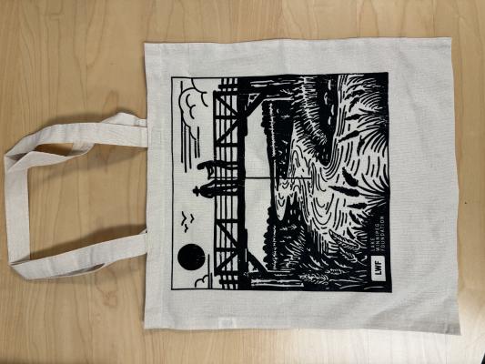
Volunteering has its perks! To kick off the tenth field season, volunteers and partners will receive their sampling equipment in new tote bags with an LWCBMN illustration, designed to commemorate our tenth field season.
Thank you to everyone who attended the gathering and to all the presenters for their excellent presentations. Stay tuned for future blog posts and links to YouTube videos of select presentations from the gathering. If you are interested in participating in LWCBMN contact fallon@lakewinnipegfoundation.org.